The Three Peaks Challenge is one of those things that seems to come up in every office and every group of friends at some point, usually for charity and usually with a fair bit of bravado. It means climbing the highest mountains in Scotland, England and Wales, which are Ben Nevis, Scafell Pike and Yr Wyddfa (Snowdon), and the classic version squeezes all three into 24 hours.
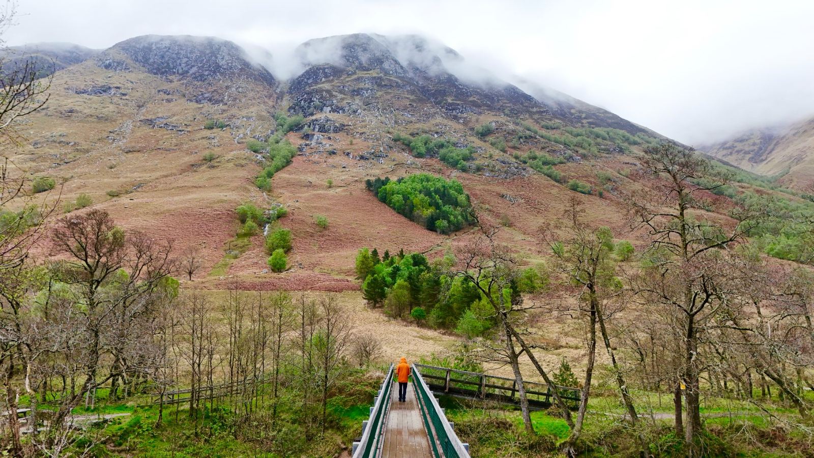
I actually completed the Three Peaks Challenge back in 2013 with a great group of friends, and all I really remember of Ben Nevis from that day is it being extremely wet, cold and foggy, with never ending turns as we wound our way up the path. So in April this year, on my NC500 road trip, I went back to see how it compared. It took me about two hours to clamber up the windy, slippery path, and near the top I was hit by blanket fog, strong wind and rain, so thick that I spent 45 minutes wandering around looking for the stone cairns that guide you across the summit plateau! Coming down was just as hard on the wet stone, but as I dropped below the cloud the views opened up and made it all worth it. Between that day in 2013 and all the planning I’ve done since, this is everything I’d want someone to know before they take on the three peaks.
What is the Three Peaks Challenge?
The National Three Peaks Challenge is to climb all three summits within 24 hours, including the driving between them. The numbers people usually quote are roughly 23 miles (37km) of walking, around 3,000 metres of ascent and about 460 miles of driving, which works out at something like 13 hours on foot and 10 to 11 hours on the road.
Don’t confuse it with the Yorkshire Three Peaks, which is a single long walk over Pen-y-ghent, Whernside and Ingleborough in the Yorkshire Dales, with no driving involved.
- Ben Nevis in Scotland, 1,345m and the highest mountain in the UK.
- Yr Wyddfa (Snowdon) in Wales, 1,085m.
- Scafell Pike in England, 978m.
Climbing Ben Nevis: how hard is it?
Ben Nevis isn’t technical in summer, but it is long and relentless, and it catches a lot of people out. Most walkers use the Mountain Track (sometimes called the Pony Track or tourist path), which starts from the Glen Nevis Visitor Centre, Achintee or the youth hostel. It’s roughly 17km there and back with over 1,300 metres of climbing, and most people take somewhere between seven and nine hours.
The path climbs steadily to the halfway lochan, then zig-zags up rough, stony ground onto the huge summit plateau. The top is in cloud a lot of the time, and in mist it’s easy to lose the path, which matters because gullies like Five Finger Gully and Gardyloo Gully drop away steeply close by. Walkers are advised to carry a map and compass and know the bearings off the summit.
Climbing it in April was a good reminder that snow can linger near the summit well into spring, and when it does, the mountain becomes a winter climb that needs the right kit and skills. If you’re fit and go on a clear summer day, it’s very achievable for a beginner, just don’t underestimate how tired your legs will be on the way down. Experienced scramblers can take the CMD Arête instead, which is a fantastic but much more serious route.
Scafell Pike walk: which route should you take?
Scafell Pike is the smallest of the three, but plenty of people find it the trickiest, as the upper slopes are a rough boulder field and the paths are less obvious in mist. There are a few main routes.
From Wasdale Head
This is the shortest and most popular way up, and the one nearly all Three Peaks groups use. It follows Lingmell Gill and the steep Brown Tongue path up to Hollow Stones and the summit, and most people take around three to five hours for the round trip. Wasdale is remote, with one narrow road in, and the parking fills up fast on busy days.
From Seathwaite in Borrowdale
If you’re not racing the clock, this is a more scenic day, heading up past Styhead Tarn and along the Corridor Route with big views across the fells. It’s longer, so allow most of a day.
From Great Langdale
The longest option, via Esk Hause, and a proper full day in the mountains. It’s a great choice if you’re staying in Langdale and want to take in more of the Lake District.
Snowdon routes: how to climb Yr Wyddfa
Yr Wyddfa, in Eryri (Snowdonia) National Park, has six main walking routes, which is part of why it’s the busiest of the three. Most take somewhere between five and seven hours there and back. In season there’s also a café at the summit and the Snowdon Mountain Railway runs up from Llanberis, so don’t be surprised if you’re sharing the top with people who came by train.
- Pyg Track, from Pen y Pass. Rocky and fairly steep, and the quickest route, which is why most Three Peaks teams use it.
- Miners’ Track, also from Pen y Pass. A gentle start past the lakes of Llyn Llydaw and Glaslyn, then a steep climb to join the Pyg Track.
- Llanberis Path, from Llanberis. The longest and most gradual, following the railway, and often suggested as the easiest route up Snowdon.
- Rhyd Ddu Path and Snowdon Ranger Path, from the west. Quieter, with lovely views.
- Watkin Path, from Nant Gwynant. It starts lowest, so it has the most climbing of all the routes.
You’ll hear about Crib Goch too, but that’s an exposed knife-edge scramble and not a walking route. The car park at Pen y Pass has needed booking in advance through the main season in recent years, and the Sherpa’r Wyddfa bus links it with Llanberis and Nant Peris, so check the Eryri National Park website before you go.
Can you do the Three Peaks Challenge in 24 hours?
Yes, but it’s hard, and a lot of that is down to the logistics rather than the walking. Most groups start with Ben Nevis, drive through the afternoon to Wasdale for Scafell Pike in the evening, then drive through the night to Snowdon and finish in the early morning. You’ll be walking at least one of the peaks in the dark, on very little sleep.
You need drivers who aren’t walking, ideally more than one, so nobody is behind the wheel exhausted, and the plan has to work at legal speeds. Traffic, a slow member of the group or a wrong turn in the mist can eat through your time quickly, so many teams treat finishing safely as the real goal and the 24 hours as a bonus. That’s why a lot of people go with an organised event, where a company or charity provides the transport, drivers, mountain leaders and timings.
Doing the Three Peaks responsibly
The challenge has a bit of a reputation with the communities around the mountains, and it’s easy to see why. Wasdale in particular is a tiny, quiet valley, and minibuses arriving in the middle of the night, slamming doors, head torches, cars parked on verges and litter left behind all add up when it happens every summer weekend.
There’s a code of practice for the National Three Peaks, originally drawn up with the fundraising sector, which asks groups to keep numbers down, avoid arriving at or leaving villages late at night where they can, use proper toilets and parking, and take everything home with them. If you’re booking an organised event, ask how they follow it.
Why doing them separately is the better trip
If you don’t need to prove anything, I’d really recommend climbing the three peaks separately. You get to do each one in daylight and in the best weather window, you can pick the nicer routes rather than the fastest ones, and you get to actually enjoy Fort William, the Lake District and Eryri rather than just seeing them through a minibus window.
Ben Nevis fits brilliantly into a trip around the Highlands (there are plenty more mountains in my Scotland gallery), and you could easily link all three into a road trip up or down the country. My guide on how to plan a road trip will help you work out the stops, and if long days on foot are your thing, have a look at the world’s greatest multi-day treks for inspiration.
Weather, navigation and kit
All three are serious mountains in bad weather, even in summer. The Mountain Weather Information Service and the Met Office both publish mountain forecasts, and it’s worth being willing to turn back if the conditions change. This is the kit I’d take on any of them.
- Waterproof jacket and trousers.
- Warm layers, a hat and gloves, even in June.
- Walking boots or shoes with good grip for wet rock.
- A paper map and compass, and the skills to use them.
- Your phone with offline maps, plus a power bank.
- A head torch with spare batteries.
- Plenty of food and water, and a small first aid kit.
When is the best time to do the Three Peaks?
The best time is roughly May to September, and June is the favourite for the 24-hour challenge as the long days mean less walking in the dark. Snow can still be lying on Ben Nevis in late spring, so check conditions if you’re going early in the season. July and August are the warmest months but also the busiest, and Scotland’s midges are out in force, so avoid bank holiday weekends if you can and bring repellent.
Whichever way you do it, plan it properly, respect the places you’re walking through, and make sure you enjoy the views when the clouds clear!
Frequently asked questions
How long does the Three Peaks Challenge take?
The National Three Peaks Challenge is designed to be done in 24 hours, with roughly 13 hours of walking and 10 to 11 hours of driving between Ben Nevis, Scafell Pike and Snowdon. Plenty of groups take a little longer. Doing the three mountains separately over several days is a much more relaxed way to climb them.
How hard is Ben Nevis for beginners?
Ben Nevis is not technical in summer via the Mountain Track, but it’s long and steep, at around 17km return with over 1,300 metres of climbing, and most people take seven to nine hours. A fit beginner can manage it in good weather. Snow can linger near the summit into spring, and in poor visibility you need to be able to use a map and compass.
What is the easiest route up Snowdon?
The Llanberis Path is usually called the easiest route up Yr Wyddfa (Snowdon), as it’s the most gradual, although it’s also the longest and follows the mountain railway. The Pyg Track and Miners’ Track from Pen y Pass are shorter but steeper and rockier. Pen y Pass parking has needed booking in season, so check before you go.
How long does it take to walk up Scafell Pike?
From Wasdale Head, the shortest route, most walkers take around three to five hours up and down. Routes from Seathwaite in Borrowdale and Great Langdale are longer and more scenic, and take most of a day. The summit area is a rough boulder field where paths are hard to follow in mist, so carry a map and compass.
What is the best time of year to do the Three Peaks?
May to September is the usual season, and June is the most popular month for the 24-hour challenge because the long daylight means less walking in the dark. Snow can still be on Ben Nevis in late spring. July and August are busier, and midges are out in Scotland, so pick a quieter weekend if you can.